Jebel Toubkal & Imlil
Jebel Toubkal, at 4,167 m (13,334 ft) the highest mountain in North Africa, draws those interested in ski-tours in winter and alpine hikers in summer. Approaching it from Marrakech on the S 501, turn to the left past Asni and follow the P 6038, an adventurous, landslide-afflicted trail, along the picturesque river oases of Mizane, to Imlil (1,800 m/5,760 ft). The rickety omnibus taxis from Asni also run here. This mountain village, has a lot of what the trekker’s heart desires, for example , equipment shops, guesthouses, guides, mules and muleteers, …
The parking area is guarded. State-examined mountain guides – among them one named Mohamed Aztat, a good-natured linguistic whiz – can be hired at negotiable daily rates. If desired they can organize the entire trek. On the other hand, the drivers of the pack-mules work for fixed, though not unreasonable tariffs. Now and then one may also ride the astoundingly sure-footed mules to shorten the walking time. It’s no problem for the drivers, who enjoy the enviable physical condition of marathon runners!
Hotels & TransfersHotels & Riads in Imlil :
Dar Adrar : www.daradrar.com
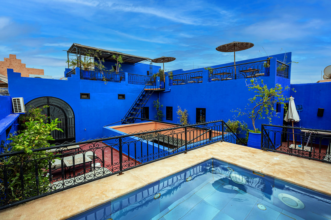
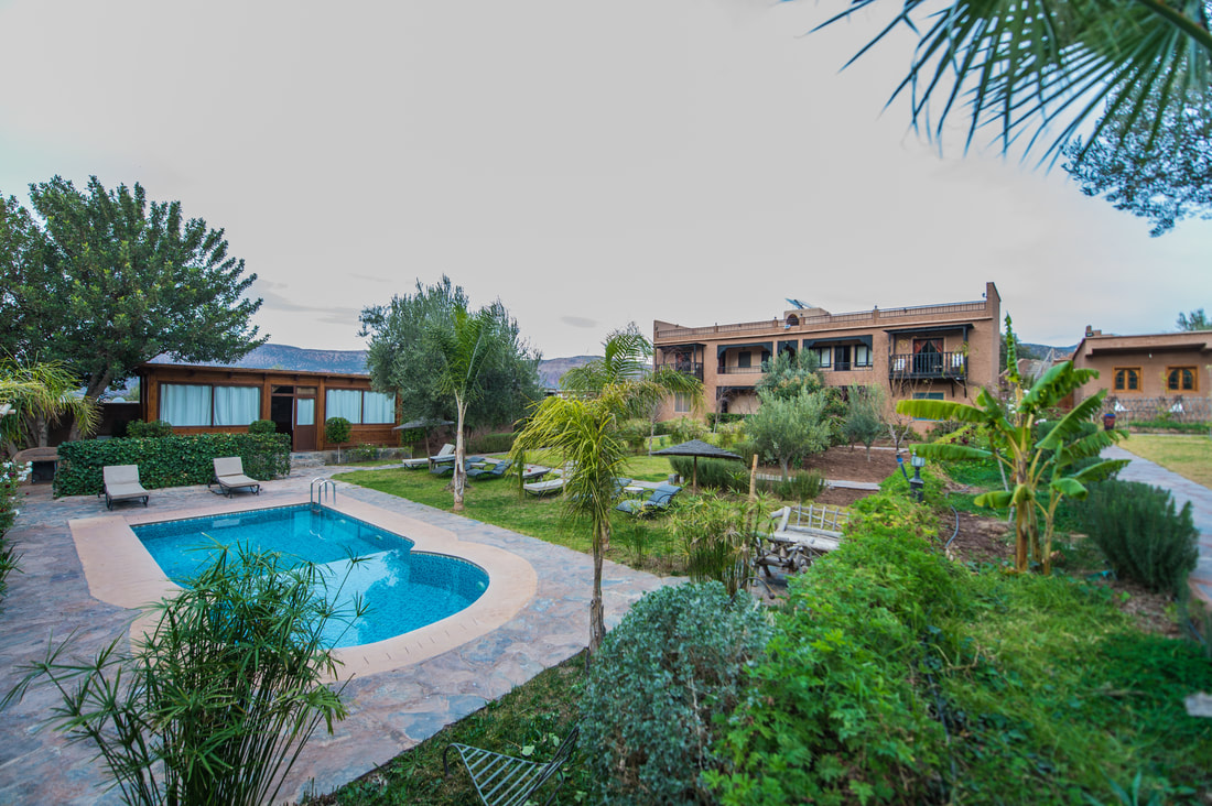
DAR ADRAR is a small & comfortable guest house in a serene mountain setting in the Toubkal National Park it’s owned by a Berber Mountain guide living for several years on the heart of the high Atlas Mountains of Morocco.
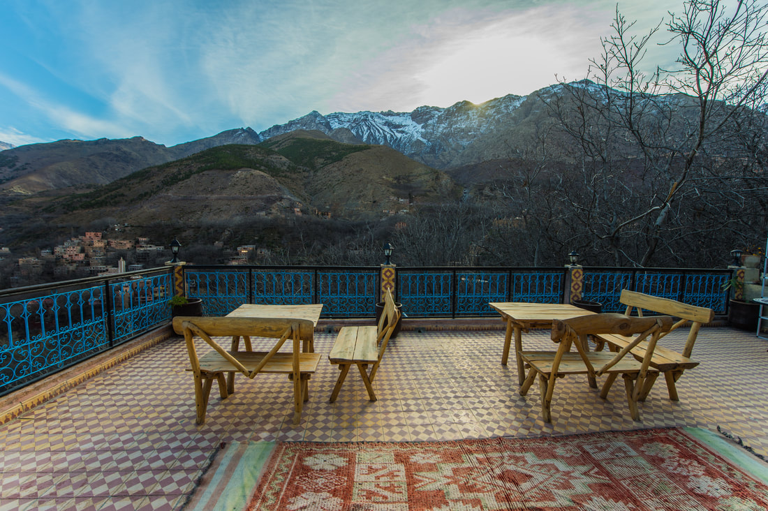
Guest HouseGuesthouse Dar Adrar features cosy and neat accommodation in beautiful, colourful Berber-style guestrooms, 5 of them with private bathrooms offering grand views over the valley (2 of them with private chimney) , as well as 5 standard rooms with shared facilities , a roof terrace with panoramic views over the Imlil valley, and an on-site Hammam or Turkish bath. A complimentary breakfast is served every day from 7 a.m. to 10 a.m. and delicious home-cooked meals can be provided on request. Guests staying at the Dar Adrar can also enjoy trekking & hiking tours starting righ away from the door, guided by the owner Mohamed Aztat himself, a qualified Atlas mountain guide and conveniently rent or buy the necessary mountaineering equipment in the on-site shop by the frontdesk.
Transfers in Morocco :
all transfers from and back to Marrakech / Imlil / Essaouirra / Ourzazate / Fes can be arranged by Mohamed Aztat , please call : 00212 6 68 76 01 65 or contact us via Email : [email protected]
When To Go?Toubkal actually gets a pretty ferocious winter and enough snow to make winter mountaineering (with ice axes and crampons) and ski mountaineering (using skins to climb on skis with articulated bindings) a prospect. Slog up, whip off the skins attached to the ski base by a Post-it Note type of reusable glue, and slide down back to base. There are many ski routes documented in a French book on the subject, a legacy of Morocco’s colonial past. This colonial past is also where the refuge system comes from. Built by the Club Alpin Francais (CAF), they are scattered around the mountains. I have visited Toubkal in February to ski but the snow cover was disappointing. Better to wait until late March for spring skiing.
But back to trekking. Most hikers will want to visit Toubkal when the snow has largely melted and before it gets too hot. That leaves April-May and September-October as the best times to visit. Trekking outside these periods affords a more tranquil experience but be prepared for colder temperatures and snow. On my ski trip, a Spanish couple dressed in jeans and sweatshirts stumbled into the refuge at 3,200m, shattered, frozen and with a dog! Despite our advice this ill-equipped pair continued up the frozen scree and patchy hard snow the following day, without ice axes or proper footwear.
Even in spring and autumn, the diurnal temperature range is enormous and you will need warm clothes, hats and gloves. Sturdy trekking shoes as opposed to big clunky climbing boots will suffice if there’s no snow. Unless you’re camping, you should only need a medium sized rucksack (no more than 50 litres) to carry your kit. Donkeys are available for hire at the road head in the village of Imlil for those wishing to camp and take the kitchen sink. But why camp when there are those perfectly positioned, well-priced refuges that will serve a decent meal?!
Which Route?
Most people head up the south col / cwm, as it is the most straightforward way up the mountain. However, there are a lot of other ways up the peak, so if you are into more than just peak bagging – it’s really worth exploring the different options. My favourite route is via the WSW ridge (Ouanoums), however, this requires full rock climbing / Alpine equipment to get the maximum enjoyment from the route. Try the north col / cwm if you want to try something slightly different – there is even wreckage of a crashed plane en-route.
The following are some basic route descriptions, however, I cannot guarantee their accuracy or be held responsible for any errors. It is up to you to check all information you receive, and ensure your own safety. As in all mountain zones you should make sure you take the appropriate equipment, including map and compass, and be prepared to navigate in Alpine conditions.
South Col / Cwm (Irhzer n’Ikhibi Janoub)Toubkal South Col
In summer conditions there are a number of tracks, which all seem to eventually lead to the top. From the headwall before Tizi-n-Toubkal is the point of most confusion, with tracks going everywhere. However, the peak is obvious in clear conditions – use your common sense and you should make it OK. Toubkal is well known for it’s scree slopes. However, over the years, with more and more people climbing the mountain, the scree slopes seem less atrocious than they used to be. In winter conditions, you may end up breaking the trail. If so, get as early a start as you can, like many alpine areas, the snow will soften later in the day making progress harder.
Setting off from the Neltner hut, cross the stream and head east for the obvious hanging valley. From the base of the steep climb there is usually a path crossing from right to left ascending the scree and rocks to gain the valley properly. Follow the valley bottom up, keeping close to the stream bed, ascending all the time until you reach the headwall of the valley. Climb this, exiting onto the slightly less steep area immediately below Tizi-n-Toubkal. After gaining the Tizi, follow the ridgeline NE. The path narrows and steepens, passing crags until the summit plateau becomes visible. Continue on to the iron pyramid. In strong winds beware of being blown off the cliff faces on the ridgeline and summit plateau.
Time to ascend: 3-5 hrs. Descent: 2-3 hrs (Depending on conditions)
GPS point of summit – N31 03.667 W7 54.928
North Col / Cwm (Irhzer n’Ikhibi Shamel)Toubkal North Col Route
Toubkal’s north col / cwm route is far more interesting than than the south col route. It also benefits from having fewer people on it. People that climb the north col route, will normally descend by the south col route. This makes a great day out with the advantage of not covering ground already seen.
Start by descending the main valley northwards for a short period. As soon as possible cross the stream and start a rising traverse. After a short time the north col / cwm should begin to be visible, head up to this over the easiest looking ground. Gain the valley properly and keep climbing steeply, passing several rock bands. Look out for parts of a crashed plane en-route. Keep left until you get to the headwall, ascend this by the obvious exit. Head for the col and enjoy the great views. Follow the rocky ridge south which steepens, finally exiting on the summit plateau.
West South West Ridge (Ouanoums)
In summer conditions it is a great climb with no great difficulties, a classic alpine ridge route – Grade III+ with an avoidable IV (HS with avoidable VS 4b.) In winter it is another story with parts of the route often quite heavily verglacé. Every year the conditions are different, depending on amounts of precipitation, sunshine etc. For conditions on the ridge it is best to check with the guardian of the Neltner hut.
To gain the ridge, from the hut head south up the hill. After a kilometre or so the Ouanoums Col (Tizi-n-Ouanoums) will become obvious. In summer conditions there will be an obvious trail from the col, as many parties climb up from the Lac du Ifni. In winter there may not be a clear trail, so be prepared to wade through the snow to gain the col.
From the col the ridge route starts at the south facing cliff. The route goes up four major steps, the third one only gained by an abseil from the top of the second climb. The rest of the ridge is easy scrambling. Once the last climb has been made, walk up to the Toubkal south peak, down to Col du Toubkal, and follow the normal south col / cwm route up to the main peak.
Climbing Preparation
You are responsible for bringing personal gear and equipment while communal equipment (tents, food, cooking items, etc.) is provided. Below is a gear list of required, recommended and optional items to bring on your climb
Technical Clothing
1 – Waterproof Jacket, breathable with hood
1 – Insulated Jacket, synthetic or down
1 – Soft Jacket, fleece or soft-shell
2 – Long Sleeve Shirt, light-weight, moisture-wicking fabric
1 – Short Sleeve Shirt, light-weight, moisture-wicking fabric
1 – Waterproof Pants, breathable (side-zipper recommended)
2 – Hiking Pants (convertible to shorts recommended)
1 – Fleece Pants
1 – Shorts (optional)
1 – Long Underwear (moisture-wicking fabric recommended)
3 – Underwear, briefs (moisture-wicking fabric recommended)
2 – Sport Bra (women)
Headwear
1 – Brimmed Hat, for sun protection
1 – Knit Hat, for warmth
1 – Balaclava, for face coverage (optional)
Handwear
1 – Gloves, warm (waterproof recommended)
Footwear
1 – Hiking Boots, warm, waterproof, broken-in, with spare laces
1 – Gym S
hoes, to wear at camp (optional)
3 – Socks, thick, wool or synthetic
3 – Sock Liners, tight, thin, synthetic, worn under socks to prevent blisters (optional)
1 – Gaiters, waterproof (optional)
Accessories
1 – Sunglasses or Goggles
1 – Backpack Cover, waterproof (optional)
1 – Poncho, during rainy season (optional)
1 – Water Bottle (Nalgene, 32 oz. recommended)
1 – Water Bladder, Camelbak type (optional)
1 – Towel, lightweight, quick-dry (optional)
Equipment
1 – Sleeping Bag, warm, four seasons
1 – Sleeping Pad, self-inflating or closed-cell foam
1 – Trekking Poles (highly recommended)
1 – Head lamp, with extra batteries
1 – Duffel bag, (waterproof recommended) for porters to carry your equipment
1 – Daypack, for you to carry your personal gear
Other
Toiletries
Prescriptions
Sunscreen
Lip Balm
Insect Repellent, containing DEET
First Aid Kit
Hand Sanitizer
Toilet Paper
Wet Wipes (recommended)
Snacks, light-weight, high calorie, high energy (optional)
Pencil and Notebook, miniature, for trip log (optional)
Camera,
 RSS Feed
